

Ceará
(Portuguese pronunciation: [siaˈɾa])
Is one of the 27 states of Brazil located in the northeastern part of the country, on the Atlantic coast. It is one of the main rourist destinations of Brazil.
Literally, the name Ceará means "sings the jandaia". According to José de Alencar, one of the most important writers of Brazil and an authority in native languages, Ceará is composed of cemo -- to sing aloud, to claim -- , and ara -- little parakeet in a native language. There are also theories that the state name would derive from Siriará, a reference to the crabs from the seashore.
The state has dunes at Cumbuco and Jericoacoara, to the Dune Buggy and Jeep rides in Canoa Quebrada, and handcraft industries in embroidery, hammocks, and pottery. The state is best known for its extensive coastline, with 573 kilometers (356 miles) of sand. There are also mountains and valleys producing tropical fruits in the chapadas of Araripe and Apodi. To the south, on the border of Paraíba, Pernambuco and Piauí, is the National Forest of Araripe.
Geography
Ceará has an area of 148,016 km². It is bounded on the north by the Atlantic Ocean, on the east by the states of Rio Grande do Norte and Paraíba, on the south by Pernambuco state, and on the west by Piauí.
Ceará lies partly upon the northeast slope of the Brazilian Highlands and partly upon the sandy coastal plain. Its surface is a succession of great terraces, facing north and northeast, formed by the denudation of the ancient sandstone plateau which once covered this part of the continent; the terraces are seamed by watercourses, and their valleys are broken by hills and ranges of highlands. The latter are the remains of the ancient plateau, capped with horizontal strata of sandstone, and having a remarkably uniform altitude of 2000 to 2,400 ft (730 m) The flat top of such a range is called a chapada or taboleira, and its width in places is from 32 to 56 miles (90 km). The boundary line with Piauí follows one of these ranges, the Serra de Ibiapaba, which unites with another range on the southern boundary of the state, known as the Serra do Araripe.
Another range, or escarpment, crosses the state from east to west, but is broken into two principal divisions, each having several local names. These ranges are not continuous, the breaking down of the ancient plateau having been irregular and uneven.
The rivers of the state are small and, with one or two exceptions, become completely dry in the dry season. The largest is the Jaguaribe, which flows entirely across the state in a northeast direction.
Ceará has a varied environment, with mangroves, caatinga, jungle, scrubland and tropical forest.
The higher ranges intercept considerable moisture from the prevailing trade winds, and their flanks and valleys are covered with a tropical forest which is typical of the region, gathering species from tropical forests, caatinga and cerrado.
The less elevated areas of the plateaus are either thinly wooded or open campo. Most of the region at the lower altitudes is characterized by scrubby forests called caatingas, which is an, endemic Brazilian vegetation. The sandy, coastal plain, with a width of 12 to 18 miles (29 km), is nearly bare of vegetation, although the coast has many enclaves of restingas forests and mangroves.
The soil is, in general, thin and porous and does not retain moisture, consequently the long, dry season turns the country into a barren desert, relieved only by vegetation along the riverways and mountain ranges, and by the hardy, widely distributed Carnauba Palm (Copernicia cerifera), which in places forms groves of considerable extent. Some areas in the higher ranges of Serra da Ibiapaba, Serra do Araripe and others are more appropriate to agriculture as its soil and vegetation are less affected by the dry seasons.
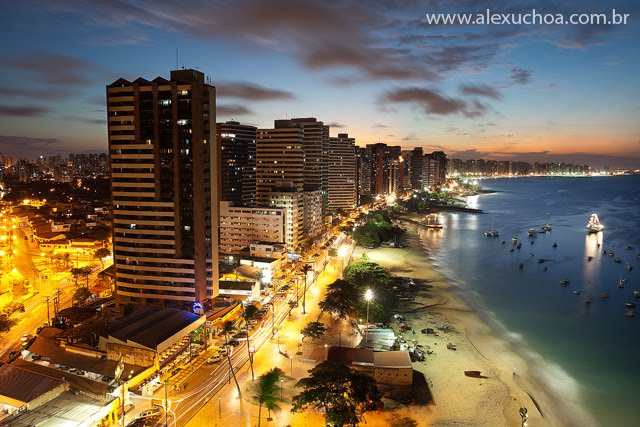
The endless stretch of beaches in the state is a major tourist attraction. Ceará has several famous beaches such as Canoa Quebrada, Jericoacoara, Morro Branco, Taíba, Cumbuco, Portdo da Dunas, Iguape, Prainha, Praia do Futuro and Flexeiras. The beaches are divided into two groups (in relation to the capital Fortaleza): Sunset Coast (Costa do Sol poente) and Sunrise Coast (Costa do Sol nascente).
Climate
The climate is hot and humid on the coast, tempered by the cool trade winds; but in the more elevated, semi-arid regions it is very hot and dry (often above 35 °C, but seldom above 40 °C), although the nights are cool. However, in the higher ranges (Serra da Ibiapaba, Serra do Araripe and several less larger highlands) the temperatures are colder and vary from about 14 °C to 34 °C (the minimum temperature registered in Ceará took place in Jardim, a small city in Serra do Araripe: 8 °C).
The year is divided into a rainy and dry season, the rains beginning in January to March and lasting until June. The dry season, July to December is sometimes broken by slight showers in September and October, but these are of very slight importance. This environment and temperature attracts many tourist, especially ecotourists.
The climate is hot almost all year round. The temperature in the state varies from 22 °C to 36 °C with the lowest temperatures not being typical in the capital Fortaleza but in the numerous mountains in the state.
History
The territory of Ceará includes three of the capitanias originally granted by the Portuguese crown in 1534. The first attempts to settle the territory failed, and the earliest Portuguese settlement was made near the mouth of the Camocim River in 1604. Ceará was first successfully colonised by the Portuguese soldier Martim Soares Moreno in 1612, when what is today Brazil was hotly contested by the Dutch and the Portuguese.
The area was invaded twice by the Dutch, in 1644 and in 1654. Both times the settlers were ultimately repelled. Before being defeated, however, the Dutch founded what is today Fortaleza where they constructed Fort Schoonenburg, so named after one of their commanders. In 1661, the Netherlands formally ceded their Brazilian territories to the Portuguese crown, ending conflict in the region. Ceará became a dependency of Pernambuco in 1680; this relationship lasted until 1799, when the Captaincy of Ceará was made independent.
The fight for Brazilian independence in 1822 was fierce in Ceará, with the area being a rebel stronghold that incurred vicious retribution from loyalists. The captaincy became a province in 1822 under Dom Pedro I. A revolution followed in 1824, the president of the province was deposed fifteen days after his arrival, and a republic was proclaimed. Internal dissensions immediately broke out, the new president was assassinated, and after a brief reign of terror the province resumed its allegiance to the empire. Ceará was one of the first provinces of Brazil to abolish slavery.
The reign of Dom Pedro II (see Empire of Brazil) saw great advances in infrastructure in Ceará, with the commerce increasing by a large amount, and with gas lighting becoming almost ubiquitous.
The state of Ceará became a bishopric of the Roman Catholic Church in 1853, the bishop residing at Fortaleza.
Two railway lines running inland from the coast (the Baturité line from Fortaleza to Senador Pompeu, 179 miles (288 km), and the Sobral line from the port of Camocim to Ipu, 134 miles) by the national government after the drought of 1877–1878 to give work to the starving refugees, and were later operated under leases. Dams were also begun for irrigation purposes.
The population numbered 805,687 in 1890, and 849,127 in 1900. In 1900 approximately five-sixths of the population lived on estates, owned no property, paid no taxes, and derived few benefits from the social and political institutions about them. Education was then confined almost exclusively to the upper classes, from which came some of the most prominent men in Brazilian politics and literature.
In the early 20th century the sandy zone along the coast was nearly barren, but the more elevated region behind the coast with broken surfaces and sandy soil produced fruit and most tropical products when conditions are favorable. The natural vegetable production was important, and included manigoba or Ceara rubber, carnaúba wax and fiber, caju wine and ipecacuanha. The principal agricultural products were cotton, coffee, sugar, mandioca and tropical fruits. The production of cotton increased largely with the development of cotton manufactures in Brazil.
The higher plateau was devoted almost exclusively to cattle raising, once the principal industry of the state, although recurring droughts created an obstacle to its profitable development. The state exported considerable amounts of cattle, hides and skins.
Since 1960, the Orós Dam, comparable in size to the Aswan Dam has supplied Ceará with much of its water, and in 1995 construction began on the enormous Castanhão Dam, which, when completed, will be able to hold 6.5 km³ of water.
Do you know when Jericoacoara was settled and by whom? I had read 1920s by Portuguese fishermen but cannot find anything to substantiate that. Thanks!
ReplyDelete